- text and edit by
- ウェブ版「カルチベイト」チーム
乃村工藝社グループでは、『Cultivate(カルチベイト)』というオウンドメディアを発行し、社会に対し提言してきました。わたしたちをとりまく「文化環境」のエレメントとしての、「知」や「情報」、「創造性」「コミュニケーション」といったテーマを多面的に考察し、新たな文化の地平を切り開くことをコンセプトに、さまざまな有識者へのインタビューや対談を通じて、これからの「文化環境」のあり方へのアプローチを行ってきました。
その『Cultivate(カルチベイト)』が10年ぶりに、Web版として「ノムログ」で再始動します。第2弾となる今回のテーマは、地図から読み解く地域の歴史、そして空想展示の可能性 です。地域に根差したミュージアムの、これからのあり方を考えます。
関連記事:Cultivate Vol.1 ミュージアムは、収蔵庫で「魅せる」時代へ
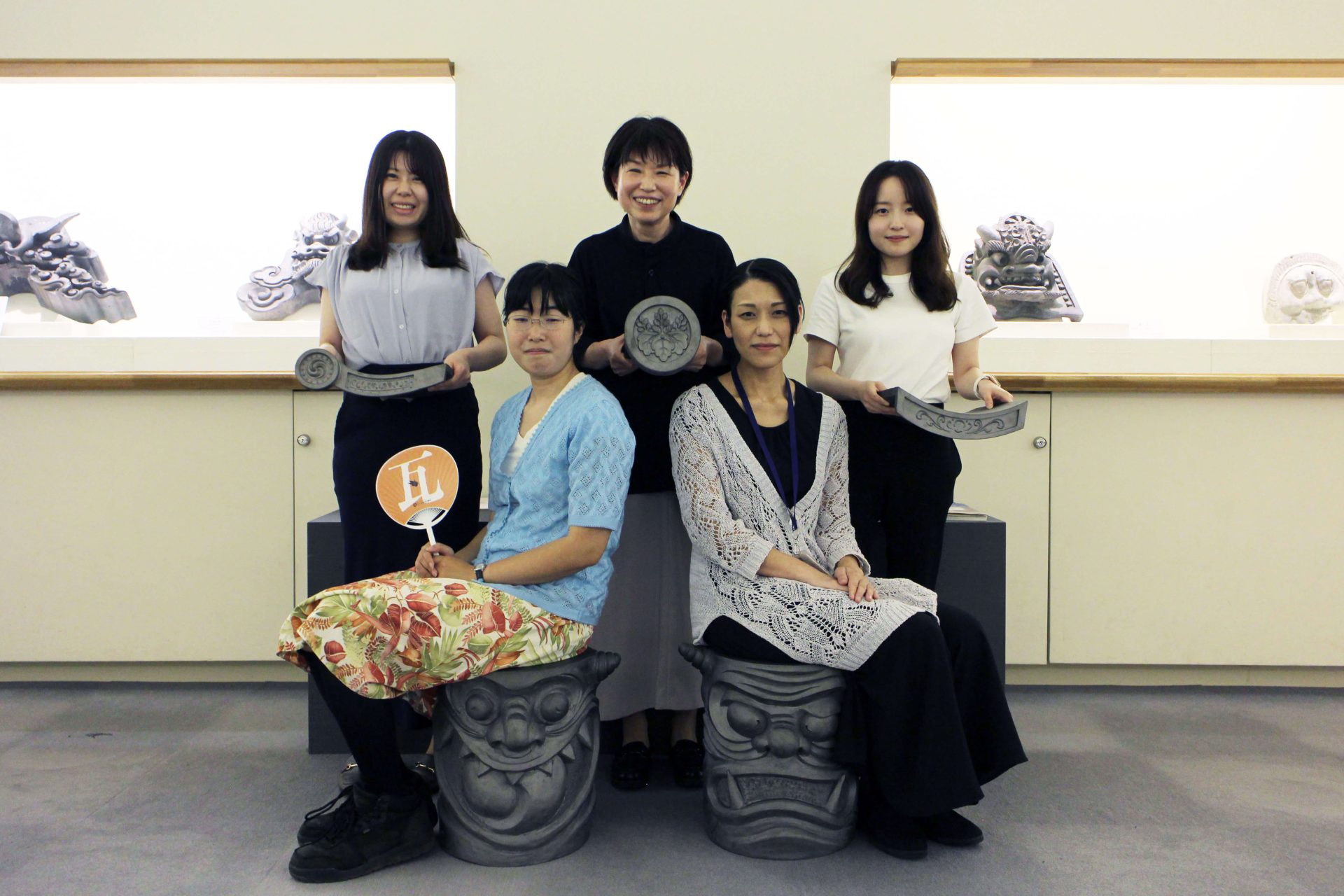
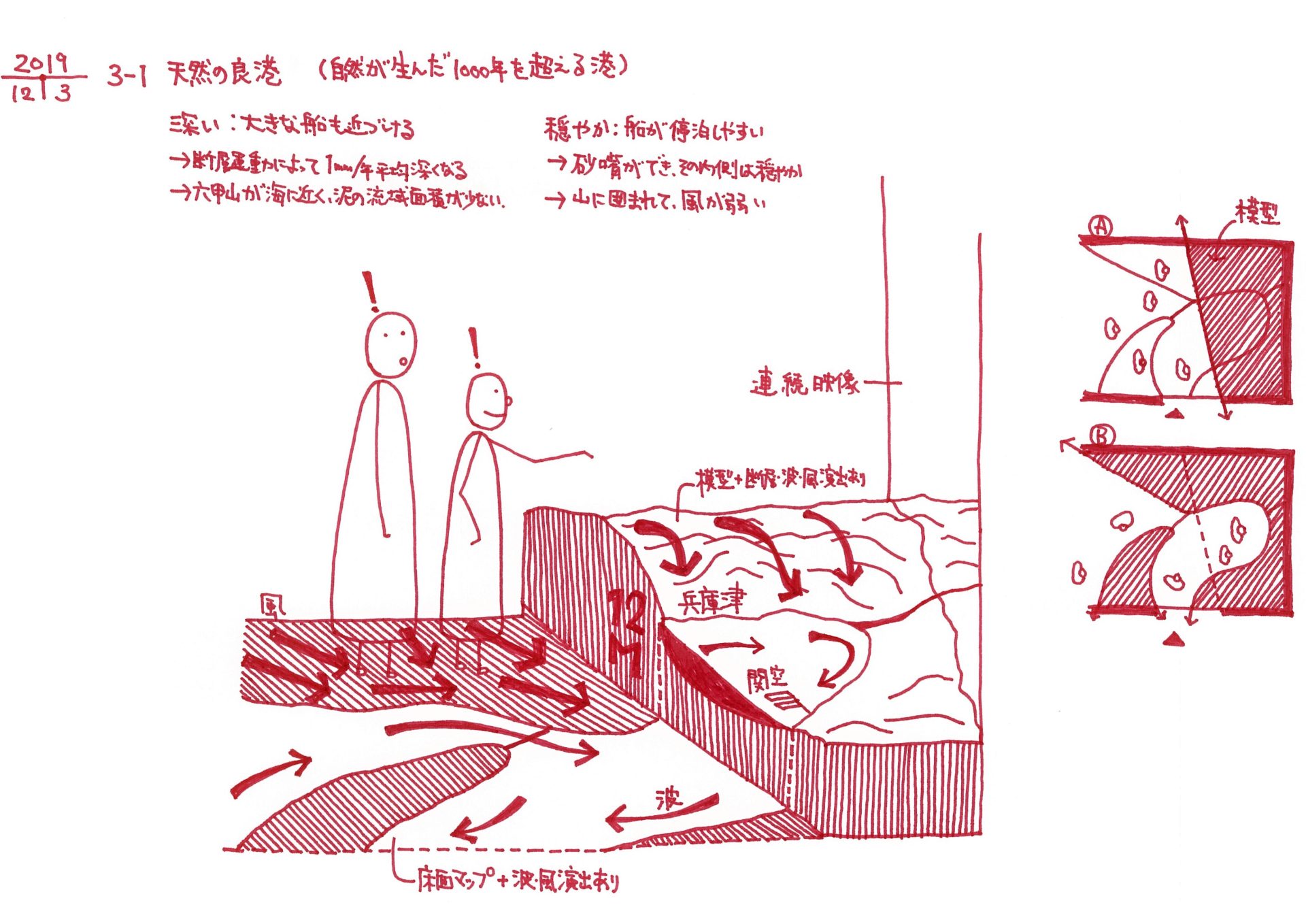
JR神戸駅や神戸港、神戸空港もほど近いエリアに位置する「兵庫津(ひょうごのつ)ミュージアム」。平清盛が活躍していた平安時代から、千年を超える歴史を誇る港湾都市・兵庫津は、「兵庫県」の県名のもととなった場所であり、明治時代、廃藩置県後に兵庫県の初代県庁が置かれた“始まりの地”です。「兵庫県立兵庫津ミュージアム」は、令和3(2021)年11月に開館した「初代県庁館」と、翌年11月に開館した「ひょうごはじまり館」のふたつの施設で構成されています。
「初代県庁館」は、その名前の通り、初代県庁舎を復元した施設で、初代県知事・伊藤博文の執務室や仮牢、庭園などを再現展示。「バーチャルVisit!」など、リアルな展示と映像を活用した展示で、当時にタイムスリップした気分を味わえる空間です。そして「ひょうごはじまり館」は、“見て・聞いて・触る”をコンセプトに、ミュージカル仕立てのシアター、アニメーションなどの親しみやすい表現を取り入れた映像、多彩なグラフィックなどを通して、兵庫津の長い歴史を少しでもわかりやすく、面白く伝えることを大切にしています。
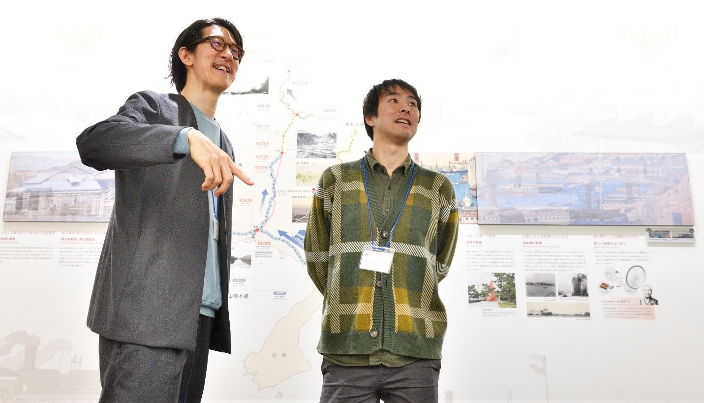
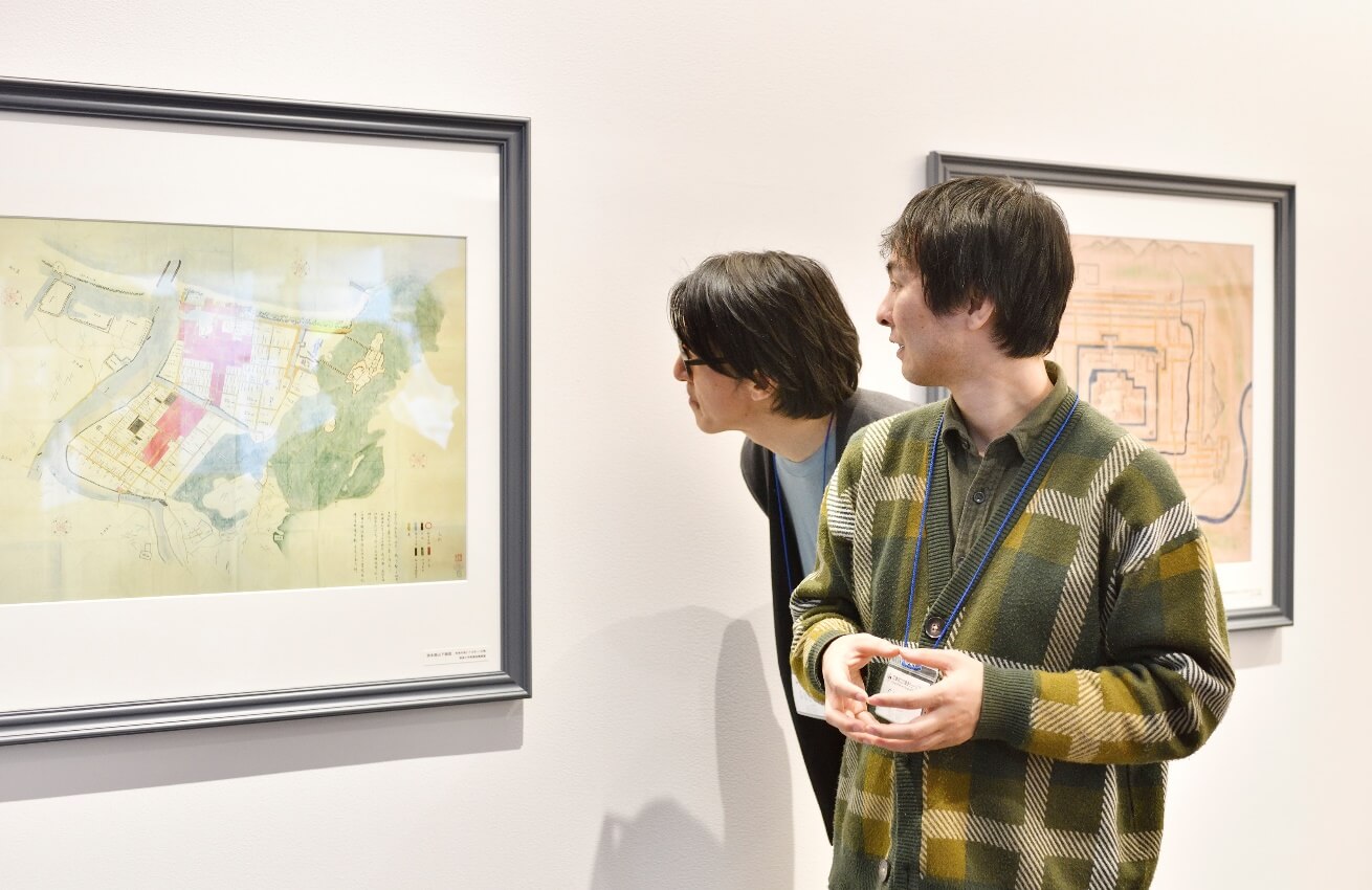
今回は、空想地図作家として、地図デザインやテレビドラマの地理監修・地図制作にも携わる「地理人」こと今和泉 隆行さんを「ひょうごはじまり館」にお招きし、同館を手がけたプランナー・岸田と共に館内を巡りながら、多層的な地域の歴史をいかに伝えるか、また、より良い博物館展示の在り方について、地理学や歴史学、考古学など、学際的な視点もふまえながら対談しました。
対談者プロフィール
「地理人」こと 今和泉 隆行さん(写真右)
空想地図作家 株式会社 地理人研究所代表
7歳の頃から空想地図(実在しない都市の地図)を描く空想地図作家。大学生時代に47都道府県300都市を回って全国の土地勘をつけ、地図デザイン、テレビドラマの地理監修・地図制作にも携わる他、地図を通じた人の営みを読み解き、新たな都市の見方、伝え方作りを実践している。
https://www.chirijin.com/
「展示師」こと乃村工藝社 岸田 匡平(写真左)
地域の魅力を伝えるプランナー。
展示をきっかけに、地域の魅力を再発見し地域のファンを増やすことを目指している。大学時代には、フィールドワークとワークショップを組み合わせて、地域住民の記憶を綴る「モノガタル地図」づくりの活動に取り組む。「地図感覚」には、展示づくりにも大きな可能性があると考えている。
時間と共に隠れてしまった、地域の歴史と魅力を読み解く
地理人さんが全国各地の都市を実際に訪ね始めたのは、大学時代のことでした。すでに300以上もの都市へ足を運んできたそうですが、「ひょうごはじまり館」が位置する兵庫津は初訪問だと言います。
対談取材を行った当日朝、飛行機で神戸空港に到着した地理人さん。なんと事前に数時間かけて地域をくまなく歩いてフィールドワークをしてくださっていました。
岸田
あらかじめこの地域の地図を古い時代のものから幅広くリサーチしてくださったそうですが、実際にご自身の足で兵庫津を歩かれてみて、新しい発見はありましたか。
地理人さん
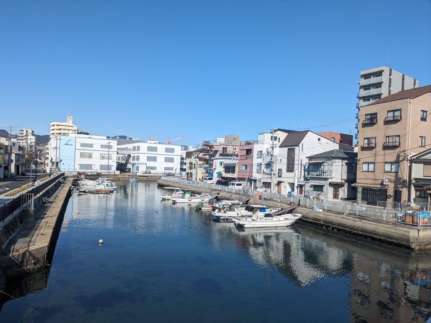
これまで訪れてこなかったことをちょっと後悔したほど、楽しかったです。以前から岸田さんに兵庫津の話を伺っていて、とても気になっていました。調べれば調べるほど、兵庫津が、神戸の歴史において重要な場所だということに気づいていったのですが、今現在の兵庫津の地図を見ただけでは、ここが旧市街地だったとは見抜けませんでしたね。
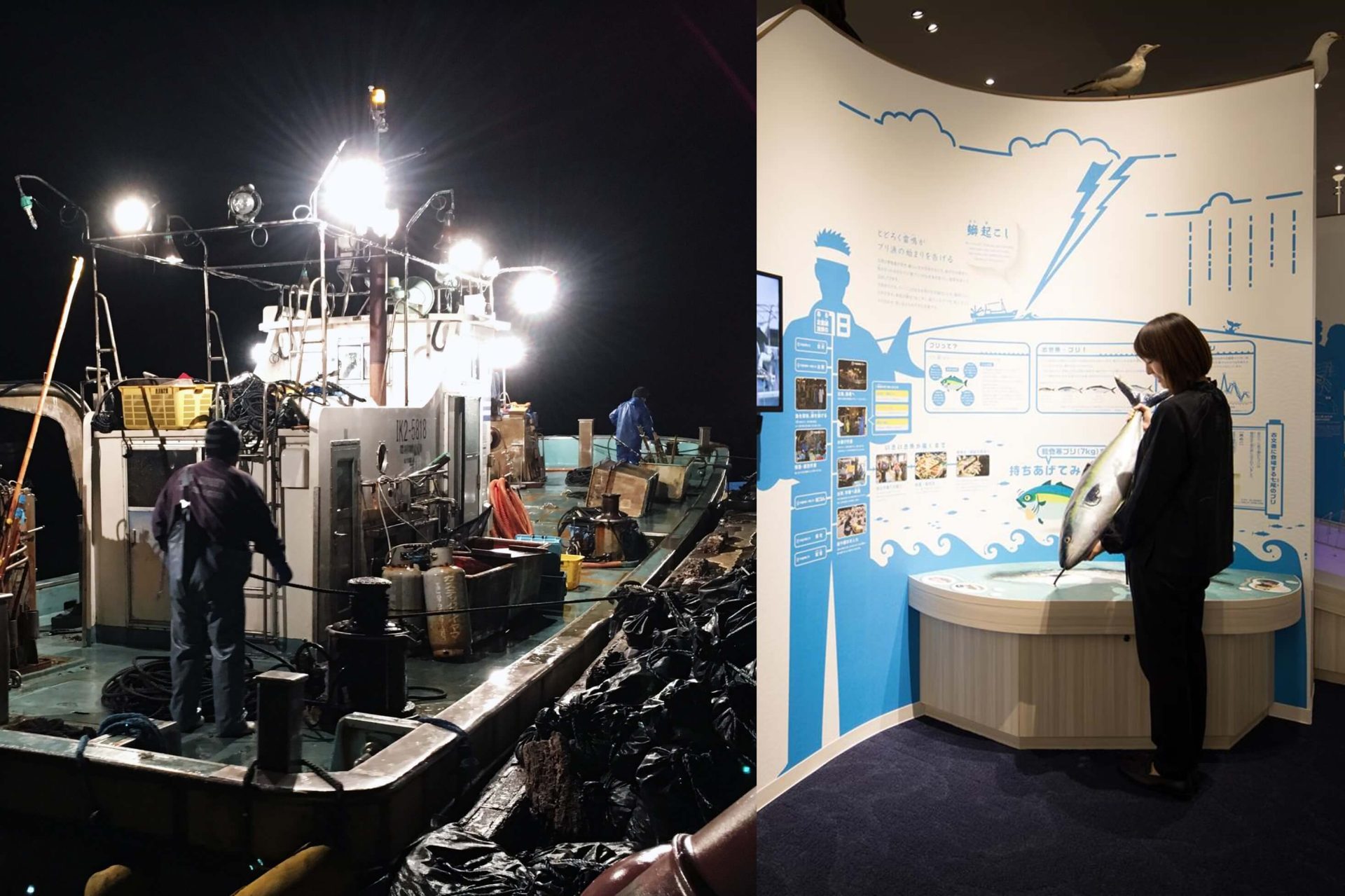
今日、実際に街を歩いてみて驚きました。地図を見て調べていた時点では、ここが本当に歴史ある港町だったのか大いに疑問でしたが、現在の新しい市場に建て替わる前の市場の古い写真を見たり、個人所有と思われる小型船が数多く停泊する「船だまり」を見つけて、本当に今も港町なんだ、と実感しましたね。海苔屋さんや水産加工業の会社も見かけましたし。
岸田
これまで本当に数多くの場所を見てこられた地理人さんでも、地図を見ていた時と現地を訪れた時とで、違った印象になるのですね。街の散策は、「ひょうごはじまり館」の来館者にもおすすめですか?
地理人
はい、ぜひ実際の街を見てほしいですね。特に「船だまり」の存在は、古くから港町だったことを意味していますし、その賑わいみたいなものが凝縮されている場所だと思います。
兵庫津は明治になって運河ができたそうですが、運河がある、というだけでは、ここが古くからの港町だった、ということまでは見えてきません。加えて、周辺の道路が区画整理されてしまっていたので、地図からはむしろ新しい工業地帯や住宅地に見えてしまい、一見わかりませんでした。しかし、小さい船がたくさん停泊していて、周辺に中小の水産加工会社がある様子を見て、おそらく江戸時代からすでに人々がたくさんいて賑わっていたのだな、と想像しました。ただ、そこを見ないと古い港町だと感じることはとても難しいところです。
道路の区画整理は戦後に実施されたと思いますが、戦後間もない頃の古い建築物はあまり見られず、見た感じ1970年代から2000年代くらいに建てられたと思われる建物が多いことが印象的でした。区画整理されたことで、大通りだけではなく、住宅街の細い路地なども、自動車がすれ違うことのできる道幅になったことで、ビルが建てやすく、次々に建て替えが進んだのでしょう。居住環境や防災の観点からは良かったのだとは思いますが、古い港町らしさは見えにくくなっています。さらに旧町名や旧町域も、1960年代に施行された、住居表示に関する法律によって変わっています。結果、現在の地図にも記されるような古い町の原形が、おそらく1960年代後半〜1970年代頃で見えなくなってしまった、と言えるかもしれません。
岸田
探偵みたいですね!地図感覚で街を観察すると、歴史や文化とのつながりを感じ、新たな発見が待っていることを実感します。博物館でも歴史や文化について興味関心を深めていただき、街と博物館を行き来することで、街への愛着がさらに深まるように思いました。
空想地図作家・地理人さんがフィールドワークを欠かさない理由
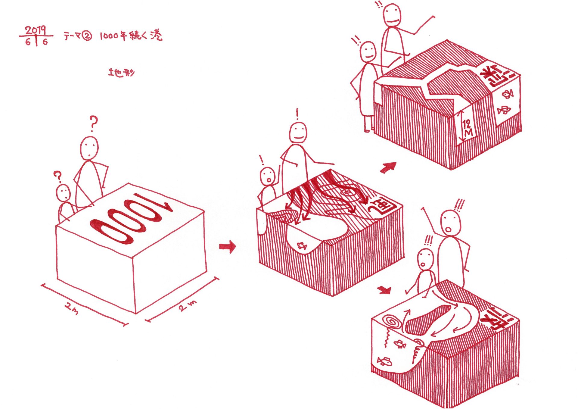
地理人さんは、自身のライフワークとも言える、「中村市(なごむるし)」の空想地図を、30年以上にわたって断続的に更新し続けています。これまでも様々な空想地図を構想してきた地理人さんに、空想地図に描く場所の歴史を、どのくらいの長さで考えているのか、と訪ねたところ、なんと「150年くらいは必要」という返答が。その長いタイムスパンで考える背景には、地図と実際の街から様々な物事を読み解いていく、丁寧な姿勢と鋭い観察力がありました。
岸田
空想地図は、現実の地図と変わらないリアリティを持っていますが、空想地図をつくる際に、実際の街を歩いて観察することが、どのように活きているのでしょうか。
地理人さん
はい。空想地図というと、どこかファンタジーのような、いわゆる理想の街を描いているかのようなイメージを抱かれるかもしれません。しかし、私は全くそんなことはなくて、むしろうまくいかない現実も含めて、現実の成り立ちを追いたいスタンスです。
例えば、江戸時代にお城ができて、その周辺にうまれた城下町のなごりが現在も残っている地域には、どこか歴史を感じるような雰囲気がありますよね。その地域を訪れたとき、なぜ歴史を感じたのか。その理由や要素を確認したくなるのです。
そうやって抽出されていった街や地域が持つ“らしさ”、歴史を感じる街らしさや、再開発された街らしさ、1960年代の高度成長期に宅地開発された地域のらしさ、といったものを、現実の街や地域に少しずつラフスケッチしていくような感覚で、空想地図を描いていきます。現地に足を運ぶことで、空想地図に描ける要素が増えていくイメージですね。
ドラマの小道具やゲームの舞台で空想地図の依頼が来ることもあるんですが、実際の都市の土地勘が増えたことで、さまざまな依頼に応えられるようになりました。ドラマの脚本やゲームの作者が描きたい世界が、現実的に浮かび上がってくる感覚は、確かにフィールドワークの結果かもしれませんね。
岸田
実際の地域で採集した“らしさ”が、抽象化されて、空想地図となったとたんに、中村市らしさが浮かび上がるってことが面白いですね。地理人さんのフィールドワークの積み重ねが、非常にユニークな活動を支えていることがよく分かりました。博物館の展示でも、その地域らしさや博物館らしさを企画している時は大変で、楽しい時間です。地図感覚は、地域らしさを採集する方法でもあり、伝える方法でもあるように思います。
地理人さん
博物館こそ、見る人は初めて知る世界、知らない世界を体感しに来ると思うのですが、岸田さんはさまざまな世界をつかむこと、そしてそれを伝える形づくり、と二段階あると思うので、それをできるのはすごいと思うと同時に、大変そうでもあり、楽しそうでもあります。
俯瞰する視点と“縦糸”と“横糸”を深く読み解くまなざしで、もっと展示を面白く
ここで地理人さんを「ひょうごはじまり館」へご案内。同館の学芸員の多賀茂治さん、運営の展示ディレクターの神 剛司さんにも同行いただき、一緒に展示を鑑賞しました。対談の締めくくりに地理人さんと展示師・岸田が語ったのは、空想地図ならぬ、空想展示について、でした。
岸田
「ひょうごはじまり館」の展示は、地形から始まります。兵庫津は1000年以上の歴史があり、平清盛や足利義満、伊藤博文など多くの先人が関わっていました。恵まれた地形を利用して、発展してきたことなど、歴史に影響を与えていたことも分かったので、地形から展示を始めるアプローチを提案しました。歴史の展示であろうと、自然の展示だろうと、展示を空想する際、地図感覚で考え表現することに面白さを感じています。
地理人
そう言ってもらえると嬉しいですね。
私は展示を見ていると、地図から様々なことを読み解く自分にはない、学芸員の方や展示を監修した方の、“視点”をトレースしているような感覚を抱くことがあります。
例えば、私は考古学的な視点を持ち合わせてはいないので、発掘した石をなぜいくつも展示するのか不思議に思いますが、考古学の人はこれらの石から様々なことを読み解いているのですよね。
そういえば、今ふと思い出したのですが、社会科系の大学では、歴史学や地理学、考古学、文化人類学など、様々な分野を研究しています。それぞれの“視点”は異なりますが、実は研究分野のなかで何となく重なるポイントがあると思うのです。
例えば、地図は一枚絵で全体像を捉える図なので、地理学の人たちは全体像を面で見ようとする傾向があると思います。現代の事も歴史的なことも、地図を見ているだけではなく、統計やデータにもあたりますし、ささっとフィールドワークを行って、その全体像を掴もうとします。
一方、歴史学の人も、同様の資料を見ているものの、いつ誰がどうだったか、といった細かな記録や、書物を深く、深く読み続けます。非常に長い読みにくい文であったとしても、むしろ長ければ長いほど噛み砕いて読み解いていくような。
布地に例えるなら、地理学の人は布として全体を捉えていて、歴史学の人は布を構成する縦糸と横糸の1本1本を読もうとするイメージでしょうか。布という面で見るのか、 糸の状態に解いて見るのか。“視点”というか、“まなざし”の違いが面白いですよね。
岸田
なるほど。地理的な視点によって、全体像をわかりやすく伝えたり、楽しんでもらえたりする。展示づくりには、糸を細かく見るような視点だけではなく、布のような面でとらえる視点を入れることが必要ですね。
地理人
加えて、この兵庫県立兵庫津ミュージアムのように、“実際に歴史が紡がれてきたその場所にある”という事も、非常に大切だと思います。ここまでお話ししてきて、自分だったら、解いた糸を現代の街にどう通していくのか、をやってみたくなりました。“本当にこの場所だったんだ!”と、来館者に実感してもらえるような、歴史上の場所や出来事と現代の場所とを縫い合わせるようなことをやってみたいな、と。
岸田
まさに、博物館と地域をどうつなげていくのか、という視点ですね。
地理人
はい。そのために例えばですが、常設展示室は明治時代の紹介で締めくくられていましたが、その先の時代、大正・昭和・平成の出来事を、写真や地図などで伝えるような展示が加わると、よりリアルに、現代と地続きなんだな、という感覚が得られるかもしれません。
岸田
地域とつなげる、という視点で言えば、この地域の歴史を案内する活動をされている方々とのコミュニケーションや、一緒にできそうな取り組みを考えることにも活かせそうです。展示の空想が浮かんできそうです。今日は本当にありがとうございました!
文:naomi
この記事は気に入りましたか?
- editor
-
-
これからの「文化環境」のあり方を提言する『Cultivate(カルチベイト)』、10年ぶりにウェブ版として「ノムログ」で再始動